Miranda Shellbank Earthcache (Waikato) EarthCache
Miranda Shellbank Earthcache (Waikato)
-
Difficulty:
-

-
Terrain:
-
Size:  (other)
Please note Use of geocaching.com services is subject to the terms and conditions
in our disclaimer.
A Earthcache at Miranda shellbank, in The Firth of Thames.
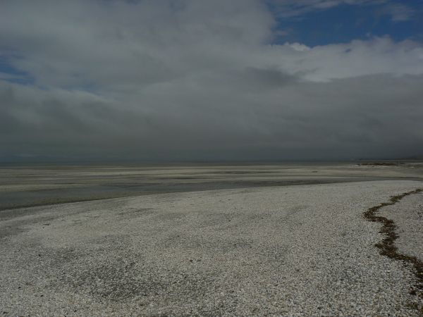
What is a chenier plain?
It is a coastal plain made up of shell and/or sand built on top of marine muds. The gradual build up is shown by the series of humps and hollows seen as you look across from the sea to the hills beyond. This coastal plain is still evolving today. In order to increase in size these formations need a particular combination of factors:
- Shell supply
- Low energy sea wave action
- The presence of a saltmarsh type environment
- A constant along-shore drift pattern
All these factors must be relatively constant over a very long period of time.
How do they form?
Sand bars form on the foreshore which gradually migrate landward. As shell ridges and storm crests form on the bars fine sediments accumulate in the tidal flat bay which forms in the lee of the ridge. This tidal flat bay is then colonised by mangroves or salt marsh. Eventually enough sediment accumulates to raise the area above the tideline. The landward movement of the chenier ridge stops once a further chenier forms seaward of an earlier one.
The miranda chenier plain
This is a unique landform within New Zealand and a rare landform globally. The ridges have formed over thousands of years. The area is stable and therefore especially well suited for the study of sea level fluctuations over the last few thousand years.
To log this EarthCache, you must do the following and email us the results. You can go ahead and log your find, (ie. you don't need to wait for permission) but if we don’t think you have honestly completed the required tasks we will delete your log (after emailing you first of course):
1)Describe the general profile of the shell bank. If you could slice a typical cross-section through the shell bank, is it symmetrical or is one side steeper or shallower than the other? if so why do you think that?
2)Can you identify the high water mark along the shell bank? Is yes, how can you?
3)Take a photo of yourself with gps on the seashells, post it with your log.
Please email me this info, please DO NOT post it with your log. Just post your photo.
Additional Hints
(No hints available.)