Weirly Fast (Dunedin, Otago) Traditional Geocache
Weirly Fast (Dunedin, Otago)
-
Difficulty:
-

-
Terrain:
-

Size:  (regular)
Please note Use of geocaching.com services is subject to the terms and conditions
in our disclaimer.
This cache on the Silverstream water race is weirly fast to get to!
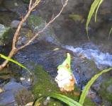
From Whare Flat road it’s just a two minute walk and boulder-hop across a stream to get to the North Whare Creek weir. You're looking for a 2 litre black snaplock, well above flood level.
 It was somewhere near here that the Silverstream water race was formally opened, on 15 December 1881.
The Mayor, Mr Ross, raised a sluice gate to open the channel. He then used a two-foot rule to break a bottle of “real Roederer” champagne “thus affording the citizens of Dunedin a taste of that celebrated compound in the first water drawn from the new supply”.
Our ratepayers’ representatives then “pluckily completed” the picturesque 3 ½ mile walk to the head of the race. By this time several of the party had “had enough” and “it was deemed advisable to use all promptitude in returning to the buggies and the bottled beer”. The “baked” Chairman of the Water Supply Commission managed to borrow a horse and “after this arrangement all proceeded merrily, and at about 2 o’clock the party sat down to an excellent cold luncheon” in a makeshift bivvy at Whare Flat.
If you’d also like a "weirly fast" walk from here to the top weir Racemans Track, information and maps can be found at McRaes Meander or Silverstream walks (walking times given are generous).
This Silverstream water race was Dunedin’s second water supply project (Ross Creek was the first). The race ended at the Southern Reservoir Monkeying Around which was meant to hold a week’s water supply for the city, although it turned out to be too small. The alignment and tight bends in the water race were also “not up to the mark”. The race inspector lived at Whare Flat. Racemen lived beside the Flagstaff Creek intake Troll House at Flagstaff Creek (see photo gallery for diagram of intake and photo of house) and over the stream from the 1920 pump house Sandflies, Eels and Morepork.
Council reports in April and May 1880 say the first section of the water race, from the Southern Reservoir to Flagstaff Creek, was operational from October 1879 and the second section, from Flagstaff Creek to North Whare Creek, was used from April 1880. The third section from North Whare Creek up to the top weir was completed in 1881.
At the Whare Creek weirs there were no separate intakes, as there were at the other streams. The water was taken in by fluming sunk in the beds of the streams and protected by masonry and puddle wall, with a cover being provided to enable flood waters to be shut out.
The route of the water race is marked on the 1979 Mosgiel topo map (attached; use View and then Zoom to see detail). You can still identify parts of it on the WAMS aerial photo, following around from the Southern Reservoir at the 140 m level and crossing Friends Hill Rd at the pumphouse.
 The obvious hide was found for us by our friend Wallace. He’s included a full description of the location and even a spoiler photo on his personal blogsite: see Wallace's wanderings. (Photo gallery is on top right of blog page.)
Additional Hints
(Decrypt)
Haqreebbg, oruvaqfgbar, vaonax, nobhgjnvfg uvtu