The world's most
powerfull maelstrom
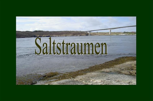
NOR:
Saltstraumen er et sund med en verdens sterkeste malstrøm.
Den smale kanalen forbinder ytre Saltfjorden med den store Skjerstadfjorden.
Hver sjette time, fosser 400 millioner kubikkmeter av vann, i hastigheter opp til 20 knop (40 km per time) gjennom et 150 meter bred en 3 km langt sund.
Virvler opp til 10 meter i diameter og 5 meters dyp dannes når strømmen er på sitt sterkeste.
Strømmen opprettes når tidevannet forsøker å fylle Skjerstadfjorden. Høydeforskjellen mellom havoverflaten og fjorden inne kan være opptil 1 meter. Når strømmen snur, er sundet farbart. Under denne tiden er det nesten blikk stille.
En tidevannes tabell for Saltstraumen kan bli funnet på Saltstraumen signalstation.
Dine oppgaver å logge denne EarthCache:
1: Anslå strømningshastighet og fortelle meg om det var høy eller lavvann.
2: Intet krav men legg gjerne med bilde av din gps med broen i bakgrunn :).
3: Send svarene på melding, og logg ivei :)
Bilder i loggene som viser deg ved siden av Saltstraumen bru er selvfølgelig velkomne.
ENG:
Saltstraumen is a sound with a strong tidal current.
The narrow channel connects the outer Saltfjord with its extention, the large Skjerstadfjord.
Every six hours, 400 million cubic meters of water at speeds of up to 20 knots (40 kiomerters per hour) rush through the 150 meter wide an 3 km long sound.
Vortices (whirlpools) up to 10 meters in diameters and 5 meters depth are formed when the current is at its strongest.
The current is created when the tide tries to fill the Skjerstadfjord.
The height difference between the sea level and the fjord inside can be up to 1 meter.
When the current turns, there is a period when the sound is navigable. At this times the current ist almost calm.
A tide table for Saltstraumen can be found at the Saltstraumen signalstation.
Your tasks to log this EarthCache:
1: Estimate the flow velocity and tell me if there was high or low-tide.
2: No requirement but please add a picture of your GPS with the bridge in background in the log :).
3: Send the answers in a message and you are welcome to log :)
Pictures in logs which show yourself next to the saltstraumen bridge are welcome.