This page has now been split into two sections:
1) The original cache description from ADV in 2009
2) A section by agcnz dated Jan 2020. This updates information after the big flood in 2019 which has wiped out or buried most of the aeroplane remnants which were close to GZ. You need to read this to help you search for the cache as the information here is provided in lieu of a hint
Section 1:
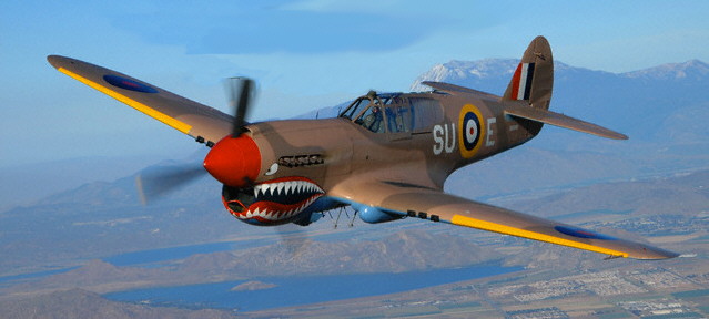
Curtiss P-40 Kittyhawk
The RNZAF operated approximately 300 Curtiss P-40 Kittyhawk's of various models between 1942 and 1946. The aircraft were mostly assigned to No's 14, 15, 16, 17, 18, 19 and 20 fighter squadrons, and carried out offensive and defensive fighter operations, bomber escort, and dive-bombing duties in the Pacific region during WWII. A total of 99 Japanese aircraft were destroyed in the air, with 14 probables recorded. Twenty P-40's were lost in combat, and a further 152 in accidents in New Zealand and overseas. The remainder were sold for scrap in 1948.
Assigned to #16 squadron at Woodbourne, P-40E Kittyhawk, serial number NZ3031, was on a training flight on May 1st 1943. While crossing a ridge above Wainoumata it was caught in a downdraft and crashed into the hill. The wreckage remains to this day but is spread over a wide area with some in the stream bed below the ridge. The cache is placed near the remains of the motor which is approx. 1km from the actual crash site. The propeller hub, part of one wing, and some of the undercarriage are reportedly also in the stream bed but some distance further up the creek.
Remains of V12 Allison Motor
From the end of Sunny Grove take the Whakanui/McKerrow track and turn off when you reach Skerrets Creek at S 41deg 17.137 E 174deg 58.277. Head directly up, and follow the creek. The gradient is easy going and you should be able to walk along the banks of the creek, swapping from side to side as needed. There are some fallen trees from small slips to negotiate in a couple of places but it is a comparitively easy off track walk otherwise. I was able to get from my car to the motor in just under 30 minutes, and keep my feet dry!
The motor is easily spotted as you make your way up the creek. The cache is very close but will require a short scramble up to it. Look for the large fallen tree spanning the creek about 15m upstream of the motor. Go under that tree then follow it up the bank until you see a large tree growing at an almost 45 deg. angle. The cache is an ammo can and in plain view at the base of that tree on a small natural platform.

FTF prize of a new unactivated 2008 NZ Recreational GPS Society Geocoin!
Section 2 by agcnz, Jan 2020
In early April 2019, a large flood hit the area and many of the trees alongside the stream have been swept away, leaving just a rocky stream bed to negotiate. The Allison V12 engine block which was sitting on the bank close to GZ has also been swept downstream and is now mostly buried. Quite a lot of the information given in Section 1 on how to find the cache is no longer valid, although the cache itself was high enough to survive the flood in perfect condition.
When searching for the cache now, there are two items that indicate where to leave the stream bed and start climbing up the true right bank towards the cache which is located as described in Section1 at the base of a large tree sloping outwards from the bank at about 45 degrees. The cache is approximately 15 metres above the stream bed, and the scramble up to it should be no problems for a reasonably agile person.
First marker - arrow in tree fern trunk, on the bank about 5 metres upstream from where you need to start climbing towards the cache
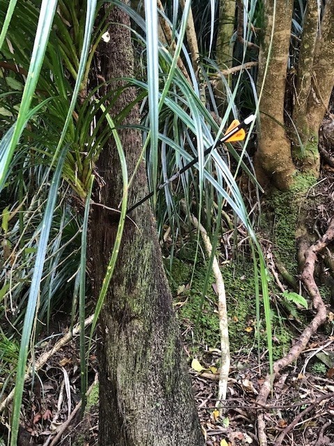
Second marker - remains of propeller hub out in stream bed about 10 metres upstream from where you need to start climbing towards the cache
